
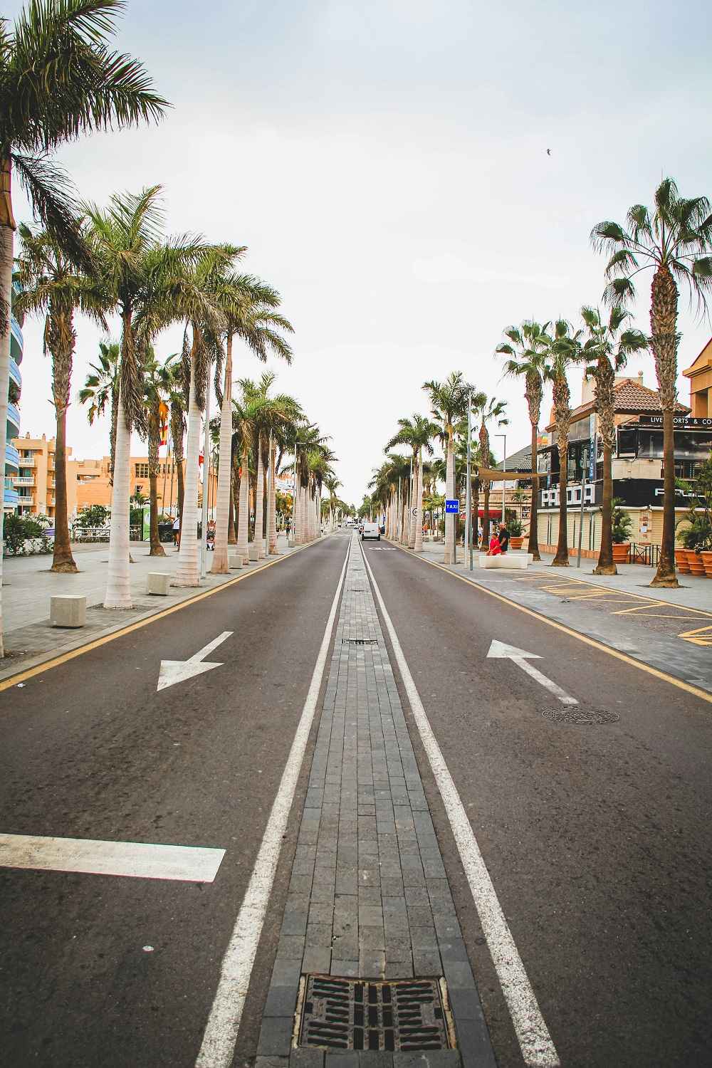
South Tenerife is a better place to run than most people expect before they arrive. The obvious appeal is the weather: running in 20°C sunshine in January, when the roads back home are dark and wet at 6am, has a particular quality that makes the early alarm easier to justify. But beyond the climate, the south has a genuinely varied range of running options, from completely flat coastal promenades suitable for someone returning from injury to challenging volcanic trail routes that will test experienced trail runners.
This guide covers six running routes in and around the south Tenerife resort corridor, with honest details on distance, surface, elevation, and who each route suits. All distances and times are estimates based on an average pace of around 5 to 6 minutes per kilometre. If you are looking for indoor training options on days when the heat is too much, see our guide to the best gyms in south Tenerife.
Contents
- Running in South Tenerife: What You Need to Know First
- Six Routes at a Glance
- Route 1: The Full Coastal Promenade, Los Cristianos to La Caleta
- Route 2: Los Cristianos to Playa de las Américas and Back
- Route 3: Barranco del Rey Trail, Costa Adeje
- Route 4: Montaña de Guaza from Los Cristianos
- Route 5: Adeje Town to the Barranco del Infierno Viewpoint
- Route 6: El Médano Beach and Montaña Roja Loop
- Running Apps Worth Using in South Tenerife
- Running in the Heat: Practical Safety Advice
- Where to Buy Running Gear in South Tenerife
- Frequently Asked Questions
Running in South Tenerife: What You Need to Know First
South Tenerife is warm year-round. In summer, temperatures regularly exceed 28°C at sea level. Running in the middle of the day in July or August is not recommended for anyone who is not heat-adapted. Early morning between 6am and 9am is the best time for running in summer. In winter, mornings and late afternoons are both comfortable.
The sun reflects off the ocean and pale volcanic surfaces. UV exposure on the coastal promenade is significantly higher than it appears, because you are catching reflected UV from the water and light-coloured pavement as well as direct sun. Apply SPF 30 or higher to all exposed skin on every run, regardless of how overcast the sky appears.
There are water stops along the coastal promenade in the form of bars and cafés, but the trail routes have no facilities whatsoever. Even for shorter coastal runs, carrying a water bottle is worth doing in summer. Dehydration in warm weather sets in faster than in cooler climates and is one of the most common problems for tourist runners in the south.
The coastal promenade is well-maintained, flat, and entirely runnable in standard road running shoes. The trail routes require trail shoes with reasonable grip, particularly on the loose volcanic rock sections of Barranco del Rey, Montaña de Guaza, and Montaña Roja.
Six Routes at a Glance
| Route | Distance | Difficulty | Elevation | Surface |
|---|---|---|---|---|
| 1. Coastal Promenade | 10km one way / 20km return | Easy | Virtually flat | Paved |
| 2. Los Cristianos to Las Américas | ~6km return | Very easy | Flat | Paved |
| 3. Barranco del Rey Trail | 5 to 7km | Moderate | ~150 to 200m | Dirt and volcanic rock |
| 4. Montaña de Guaza | 10 to 20km | Challenging | ~615m gain | Rocky trail |
| 5. Adeje to Barranco Viewpoint | 6 to 8km return | Moderate | Sustained climb | Paved + dirt trail |
| 6. El Médano and Montaña Roja | 8 to 12km | Moderate | ~170m (mountain section) | Sand + coastal path + volcanic trail |
Route 1: The Full Coastal Promenade, Los Cristianos to La Caleta
Route 1 at a Glance
| Distance | 10km one way. 20km return |
| Elevation | Virtually flat. One minor incline north of Puerto Colón |
| Surface | Paved promenade throughout |
| Difficulty | Easy. Suitable for all fitness levels |
| Time | 50 to 60 minutes one way at a comfortable pace |
| Shoes | Road running shoes |
| Start Point | Los Cristianos harbour, or anywhere along the promenade from your hotel |
| Best Time | Before 9am in summer. Any morning or late afternoon in winter |
This is the definitive running route in south Tenerife and the one most tourist runners discover on their first morning. The coastal promenade connects Los Cristianos in the east with La Caleta in the west, running continuously along the seafront for approximately 10 kilometres through every major beach and resort area.
Starting from Los Cristianos harbour heading west, the route passes through Playa de las Américas, Puerto Colón, Playa del Duque, Playa Fañabé, Playa de la Enramada, and eventually reaches La Caleta. The southern section from Los Cristianos through Las Américas is more urban, with café terraces and beach bars on either side. As you move north past Puerto Colón into Costa Adeje, the promenade becomes more natural with better ocean views and more stretches of volcanic coastline.
The promenade is shared with walkers, cyclists, and mobility scooters. Busy sections around the main beaches require patience rather than speed. The quieter northern sections towards La Caleta allow for a more sustained pace. Most runners doing the full length take a break at La Caleta for water or coffee before returning.
Route 2: Los Cristianos to Playa de las Américas and Back
Route 2 at a Glance
| Distance | Approximately 6km return |
| Elevation | Flat throughout |
| Surface | Paved promenade |
| Difficulty | Very easy. Good for beginners and recovery runs |
| Time | 30 to 35 minutes return at a comfortable pace |
| Shoes | Road running shoes |
| Start Point | Los Cristianos harbour or any beach access point along the promenade |
| Best Time | Any time of day in winter. Early morning in summer |
The shorter, more manageable version of the coastal promenade route. Works well as a daily maintenance run for tourists who want to keep ticking over without committing to a longer effort. Follow the promenade north from Los Cristianos harbour, pass through the beach corridor of Las Américas, and turn around at the 3km mark. The distance is flexible as there is no single defined turnaround point.
The busiest section of promenade in south Tenerife. Best approached as an easy run rather than an interval session. Good for running tourists who simply want to stay moving without needing to navigate.
Route 3: Barranco del Rey Trail, Costa Adeje
Route 3 at a Glance
| Distance | 5 to 7km depending on route variation |
| Elevation | Approximately 150 to 200m cumulative elevation |
| Surface | Dirt trail and volcanic rock. Trail shoes required |
| Difficulty | Moderate. For regular runners comfortable on uneven terrain |
| Time | 40 to 60 minutes depending on pace and variation |
| Shoes | Trail running shoes essential |
| Start Point | Miraverde, upper Costa Adeje. Taxi approximately 10 minutes from most Costa Adeje hotels |
| Best Time | Early morning when the trail is cooler and light is better |
Barranco del Rey is a natural ravine cutting through the landscape above the main Costa Adeje resort area. The trail follows the floor and sides of the ravine, with sections of loose volcanic rock that require attention to footing. The ascent through the ravine gives views across the south coast not visible from sea level, with Teide visible above the ridge on clear mornings.
This route is not marked as clearly as the coastal promenade. Download the trail to a running app before you go. Search “Miraverde Barranquillo Morro Guanchero” on AllTrails for the most-used version of this route. No facilities on the trail. Carry water.
Route 4: Montaña de Guaza from Los Cristianos
Route 4 at a Glance
| Distance | 10 to 20km depending on route. Full La Caldera to Montaña de Guaza circuit is 20km |
| Elevation | ~615m cumulative elevation gain on the full circuit. Most challenging on this list |
| Surface | Rocky trail throughout. Proper trail running shoes essential |
| Difficulty | Challenging to very challenging. For experienced trail runners with good fitness |
| Time | 2 to 3.5 hours depending on route and pace |
| Shoes | Trail running shoes with ankle support essential |
| Start Point | La Caldera area, south of Los Cristianos. Taxi approximately 10 to 15 minutes from Los Cristianos |
| Best Time | Early morning essential. Start before 7am in July and August |
The most serious running option within reach of the main resort area and one of the best trail runs on the island. The mountain sits above Los Cristianos and the La Caldera area. The full 20km circuit takes in 615 metres of elevation gain with excellent views across the southern coast, the ocean, and La Gomera on clear days.
A shorter version focusing on the ascent to the viewpoints below the summit reduces the distance to around 10 to 12 kilometres while still providing significant elevation. This middle-ground option suits runners who want something more challenging than the coastal promenade but are not ready for the full mountain circuit.
Carry at least 1.5 litres of water for the full circuit. There are no water sources or facilities on the mountain. Tell someone where you are going before you start. Download the route on AllTrails or Komoot first. Search “Puerto Colón Montaña de Guaza” for the confirmed GPS route. This route should not be attempted in the heat of the day in summer.
Route 5: Adeje Town to the Barranco del Infierno Viewpoint
Route 5 at a Glance
| Distance | 6 to 8km return |
| Elevation | Moderate to significant. Continuous climb from town centre to viewpoint |
| Surface | Mix of paved roads and dirt trail. Trail shoes preferred for upper sections |
| Difficulty | Moderate. For regular runners comfortable with sustained climbing |
| Time | 45 to 70 minutes depending on pace |
| Start Point | Adeje town centre. Tell the taxi driver “Adeje pueblo, Calle Los Molinos.” Approximately 10 to 15 minutes from Costa Adeje by taxi (~€15) |
| Best Time | Morning when streets are quiet and air is cooler |
This route takes advantage of the significant elevation difference between the resort strip on the coast and Adeje town a few kilometres inland and uphill. Running from the lower part of Adeje town up through the streets towards the Barranco del Infierno trailhead provides a sustained climbing effort with progressively improving views across the south coast.
This running route uses the approach road and viewpoint area below the gorge entrance. The Barranco del Infierno itself requires advance booking and an entrance fee. You do not need a booking for this running route, as you are running to the viewpoint rather than entering the reserve. To hike the gorge separately, book at barrancodelinfierno.es.
Bus routes 417 from Costa Adeje and 473 from Los Cristianos both serve Adeje town if you prefer public transport. The streets of Adeje are steeper than they appear on a map. A warm-up walk through the town before you start running is sensible preparation.
Route 6: El Médano Beach and Montaña Roja Loop
Route 6 at a Glance
| Distance | 8 to 12km depending on route variation |
| Elevation | ~170m on the Montaña Roja section. Beach sections flat |
| Surface | Mix of beach sand, coastal path, and rocky volcanic trail on the mountain. Trail shoes recommended |
| Difficulty | Moderate. Beach sections easy; mountain loop adds challenge |
| Time | 50 to 90 minutes depending on route variation |
| Start Point | El Médano town centre, approximately 25 minutes from Los Cristianos by taxi. Bus 116 from Los Cristianos also serves El Médano |
| Best Time | Morning in summer. Any time of day in winter, though afternoon wind can be significant |
El Médano offers a completely different running environment from the main resort corridor. The combination of a long sandy beach, a coastal path, and the striking red volcanic cone of Montaña Roja behind it creates a route that feels wilder and more open than anything in Costa Adeje. The town has a strong running and sporting community driven partly by the kitesurfing culture, with good café options for post-run recovery.
El Médano is one of Europe’s premier kitesurfing destinations, which tells you something about the wind. It can be strong, particularly in the afternoon. Running into the prevailing headwind on the outward leg means you have the wind at your back on the return. Go in the morning and plan accordingly.
Running Apps Worth Using in South Tenerife
| App | Best For | Key Feature for Tenerife |
|---|---|---|
| AllTrails | Trail route discovery and navigation | Barranco del Rey and Montaña de Guaza routes available with GPS, user reviews, and photos. Download for offline use before you go at alltrails.com |
| Komoot | Trail route planning and custom routes | Strong for the Adeje trail routes. Custom route builder lets you set distance and difficulty precisely |
| Strava | Tracking and finding popular local routes | Heatmap shows where other runners are running in any given area. Useful for identifying unofficial popular paths not on official trail maps |
| Google Maps | Navigating to trailheads by taxi | Share your location with a taxi driver rather than trying to describe an unmarked trailhead in Spanish. Save all start points to your phone before you travel |
Running in the Heat: Practical Safety Advice
In summer, run before 9am or after 6pm. Between 10am and 5pm in July and August, the combination of direct sun, reflected UV, and heat rising from the pavement creates conditions that cause heat exhaustion faster than most runners from northern Europe expect. The morning window is more reliable than the evening for longer runs as the temperature continues rising through the afternoon.
Drink at least 500ml of water before you start, particularly for runs longer than 5 kilometres. Carry water on any run over 30 minutes. A handheld water bottle is the minimum for the trail routes. Do not rely on finding water on any trail route as there are no facilities.
Heavy sweating, weakness, cold or pale skin, a weak pulse, nausea, and muscle cramps are the warning signs. If you feel any of these, stop running, find shade, drink water, and rest. Heat exhaustion in a warm climate can develop quickly. The coastal promenade has cafés and shaded areas along its full length that serve as natural emergency stops.
Carry some form of ID and your phone with battery charge on the Montaña de Guaza and Barranco del Rey routes. There is limited mobile coverage in places. Tell someone your route and expected return time before you set out on any trail run.
Where to Buy Running Gear in South Tenerife
Decathlon Adeje
| Address | Avenida de Ayyo s/n, Adeje. Search “Decathlon Adeje” on Google Maps |
| Opening Hours | Monday to Saturday 9am to 10pm. Closed Sunday |
| Getting There | Approximately 15 minutes from the main resort areas by taxi |
| Stock | Full range of running shoes, clothing, hydration gear, and accessories at prices broadly comparable to the UK. Best option for trail shoes and technical gear |
| Website | decathlon.es |
Sports shops in resort shopping centres carry a limited range of running clothing and accessories: basics like socks, caps, and lightweight tops. They are unlikely to stock technical trail running gear or proper running shoes. Decathlon is the right choice for anything beyond basics.
For supplements and protein products to support your training, see our dedicated guide to buying supplements in south Tenerife.
Frequently Asked Questions
Is there a good running route in Costa Adeje?
Yes. The coastal promenade from any point in Costa Adeje running either east towards Las Américas and Los Cristianos or west towards La Caleta is the most accessible and popular running route in the south. The full promenade from Los Cristianos to La Caleta is approximately 10 kilometres one way and entirely flat.
Can you run on the beach in south Tenerife?
Some sections of beach are runnable but most main resort beaches are too crowded during peak hours and have soft sand that makes running effort-intensive. El Médano beach is the best beach running option in the south, with firm sand at the water’s edge and enough length to make a meaningful session.
What is the best trail run in south Tenerife?
The Montaña de Guaza trail from La Caldera is the most rewarding within reach of the main resort area, with 615 metres of elevation gain and excellent views. Search “Puerto Colón Montaña de Guaza” on AllTrails for GPS data. The Barranco del Rey trail near Miraverde in Costa Adeje is a good moderate option for runners who want trail terrain without the full mountain commitment.
Is it safe to run alone on the trails in south Tenerife?
The main trail routes are generally safe and well-used by local runners. Carry a charged phone, tell someone your route, bring water, and avoid running alone on unfamiliar trails in the heat of the day. The coastal promenade is always safe and busy with other runners and walkers.
What time should I run in south Tenerife to avoid the heat?
In summer, run before 9am or after 6pm. In winter, the temperature is comfortable for running at almost any time of day, though mornings remain the most pleasant.
Do I need trail shoes for running in south Tenerife?
For the coastal promenade routes, road running shoes are perfectly adequate. For Barranco del Rey, Montaña de Guaza, and Montaña Roja, trail shoes with reasonable grip and ankle support are strongly recommended. The volcanic rock surfaces are uneven and can be loose in places.
Where can I buy running shoes in south Tenerife?
Decathlon at Avenida de Ayyo s/n, Adeje is the best option. Open Monday to Saturday 9am to 10pm, approximately 15 minutes from the main resort areas by taxi. Search “Decathlon Adeje” on Google Maps for directions.
Route distances and elevation data are approximate and sourced from AllTrails and Komoot user submissions. Always check current trail conditions before setting out, particularly after periods of rain. Carry water, sunscreen, and a charged phone on all routes.